Winter snow storm: School closures, snow predictions and more updates
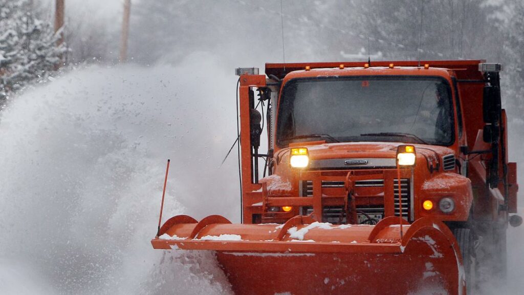
NORFOLK, Va. — Hampton Roads is preparing for significant winter weather ahead of a storm set to bring 6-10 inches of snowfall to the region.
Virginia is currently under a lingering state of emergency that was issued due to severe weather on Feb. 10. But Virginia Governor Glenn Youngkin said if there wasn’t an emergency order in effect, “I’d be declaring one today.”
Youngkin’s message on Tuesday was clear: Stay home if you can.
The general snowfall forecast is calling for 6 inches of snow in most areas with higher amounts of up to 10 inches along the Virginia/North Carolina state line. There is still the chance for some ice or mixed precipitation along the Outer Banks and coastal North Carolina near and south of the Albemarle Sound.
However, three forecast models disagree on where those highest snowfall totals will be.
The 13News Now Weather Impact Team has declared Weather Impact Alerts for Wednesday and Thursday.
Additionally, the National Weather Service issued a Winter Storm Warning, effective from Wednesday morning through Thursday afternoon. The criteria for a Winter Storm Warning is 3 inches of snow in 12 hours or 4 inches in 24 hours.
Read the full forecast here.
It’s looking like most students in Hampton Roads will be staying home on Wednesday and Thursday.
Area school districts, military bases and government offices are already announcing closures and cancellations.
Here’s an up-to-date list of closings in Coastal Virginia and Eastern North Carolina.
Additional resources and the National Guard are being mobilized to Hampton Roads and Richmond. Youngkin says the state is also moving resources onto the Eastern Shore.
Guardsmen will have transportation and debris removal capabilities.
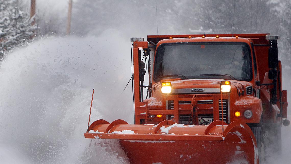
The Virginia Department of Transportation is increasing resources by 40% in the Hampton Roads area, particularly with trucks and plows, Youngkin said. Other states, including Georgia, have offered to lend resources.
Widespread disruptions to air and ground travel are expected. Because the snow will be non-stop for almost 24 hours, roadways will most likely remain unplowed until mid to late Thursday morning or Thursday afternoon.
During a Tuesday press conference, Gov. Youngkin urged Virginians to stay home. Officials are asking drivers to avoid the roads and make way for VDOT’s crews.
Road treatment is underway, and residents are asked to drive slowly.
“If you are not where you want to be by midnight tonight, don’t go,” Youngkin said. “Stay home.”
For those who have to travel during the storm, police offer the following road safety tips:
Use headlights to increase visibility. It can help you avoid slick and dangerous patches on the road, and ensure that other drivers see you.
Slow down. Reducing your speed gives you more time to safely react and avoid potential accidents.
Keep a safe distance behind other vehicles. You need more room to safely stop on slick roads! AAA recommends drivers to maintain a following distance of about five to six seconds.
Buckle Up. According to state police, most crashes during winter storms are caused by vehicles that lose control and slide into other cars, guardrails or off the road. Your seat belt is built to protect you from being thrown around inside your vehicle, preventing injury in the event of a crash.
Check your Vehicle. Be sure to clear all ice from your vehicle, check windshield wipers, tire tread and battery life. It’s crucial to ensure that your vehicle is in good working order for conditions.
Make sure you have an emergency kit in your car in case your vehicle breaks down or storm conditions worsen. Your kit should include a window scraper, blanket, snacks and bottled water, a phone charger, flashlights and batteries.
Emily Harrison spoke with the City of Virginia Beach, who want to remind the public for safety reasons to not go sledding on Mount Trashmore.
“It’s just not safe, there is no stoppage, no safety barriers, nothing to prevent people from sliding into either the parking lot or the freeway,” said Renee McKinnon, the Deputy Coordinator of Virginia Beach Emergency Management.
Read her story to see what other preparations they’re making ahead of the storm and what they want people to be aware of.
Alex Littlehales was there to witness the Taylor’s Do-It Center on Colley Avenue run out of road salt.
Even with a three bag limit, the supply was gone within minutes as virtually every customer walking in looked for salt, Alex said.
“I was going to get the third one, but the guy before me needed one, so I let him have it,” customer Jerome Wolfe laughed.
So if you’re looking for last-minute snow supplies, you might need to check a few more places than you were expecting.
Snow forecast for Hampton Roads
School closures and cancellations
Does Hampton Roads have enough snow plows?
Will it be safe to drive?
Tuesday, February 18
Virginia Beach preparations
Hardware stores with bare shelves
22
by Thomas Battle
TOPICS:
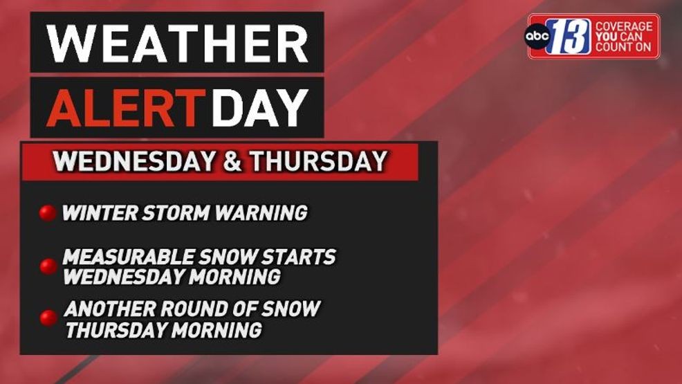
LYNCHBURG, Va. (WSET) — This Wednesday is a Weather Alert Day due to the oncoming snow we’re expecting throughout the entire day.
We’re expecting several inches of snow, with many of us falling in the 2-4 inch range, and higher totals will be seen further east. High temperatures will not break freezing, so brace for a chill on top of the snow.
Snow showers moving in today. (WSET)
Tonight a few hit-or-miss snow showers are possible, but most of us should see less snow as it tapers off. The lows will get frosty though, and could drop to the mid or low 20s before sunrise Thursday.
Weather Alert Day. (WSET)
Waking up on Thursday we’ll be much quieter weather wise, but there is another system bringing a quick dash of snow to add to what we’ve already seen.
RELATED: Inches of snow expected on Wednesday across ABC13 viewing area
We could add another inch onto the freshly fallen Wednesday snow, but this system will move out faster. We will be frigid all day though, as wind gusts pick up and kick up to near 30 mph.
This will mean wind chills will be bitterly cold all day, and could drop to the single digits as the sun sets.
Snowfall forecast. (WSET)
The sun will be coming back for the rest of the week and we should also slowly warm up as we get into the weekend. The highs on Friday are more comfortable in the 40s, with lots of sunshine all day.
Winter storm warning through Thursday. (WSET)
The weekend looks so much better and warmer, with highs slowly climbing through the 40s and getting to the 50s by early Monday.
LEGAL
TRENDING
NEWS IN PHOTOS: “Weather Extra”
Winter storm with heavy snowfall headed for Central Virginia
WRIC ABC 8News
by: Tannock Blair, Matt DiNardo
Posted: Feb 17, 2025 / 11:21 AM EST
Updated: Feb 18, 2025 / 01:44 PM EST
UPDATE: There has been a big change in the forecast with the latest weather models which increases snowfall accumulations across the area. CLICK HERE for the most recent updates.
RICHMOND, Va. (WRIC) — A powerful winter storm is set to hit Central Virginia Wednesday into Thursday.
The timing of this is such that the snow will begin as early as 8 a.m. to 11 a.m. Wednesday morning and pick up in intensity throughout the day and into Thursday morning. At this point, it looks like the snow will come to an end between 6 a.m. and 10 a.m. Thursday morning and we should get some sunshine later in the day.
This system is currently located over the Pacific Northwest and will quickly drop through the Rockies today and into the Southern Plain States on Tuesday. From that point, it will move closer to the Gulf and pick up moisture, rapidly strengthening as it then crosses Georgia into South Carolina. It will strengthen even more off the coast of South Carolina and North Carolina. This is exactly what we call a “nor’easter.”
Now, there are some factors that we need to consider as this storm develops some of those are:
That last one is especially important because it allows us to determine what we use as the snowfall ratio. That is how much snow could potentially fall. Many of you have heard the term somewhere along the way of 10:1 and that means that for every 1 inch of rainfall, or what we call liquid equivalent, would produce 10 inches of snow. That’s a good rule of thumb but it does not work in every situation. Sometimes we are a little bit warmer higher in the sky and therefore we get wetter, heavier snow, and that snowfall ratio might be 6:1 or 8:1, conversely, sometimes the air is super cold, and we get a lighter more fluffy snow and that could be a snowfall ratio of say 12:1 or 15:1. Well, this case looks to be very close to a 15:1 ratio which means that, if we were to get 1 inch of rainfall, or liquid-equivalent, we could potentially see 15 inches of snow. That is not the forecast, that is a tool we use to figure out the forecast.
Over the past 24 hours, our weather models have cut back on the amount of moisture that will be over Central Virginia. Earlier in the weekend, the weather models were putting out 1 to 1.5 inches of liquid equivalent and now that is lowered to between a 0.5 to 1 inch of liquid equivalent. That’s because the models have trended a little farther south but that also makes the air colder so all these things kind of work in conjunction with each other.
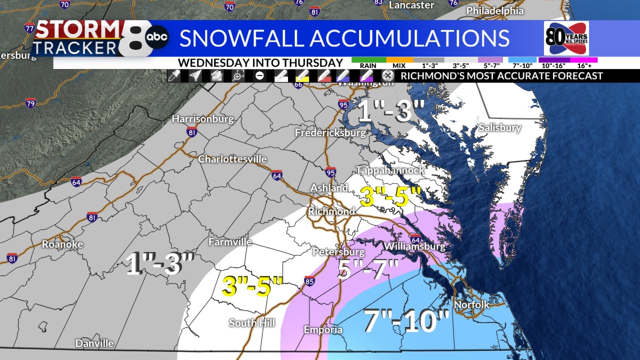
Our forecast at the present time — and it is subject to change based on how we see things changing with the different weather models over the next 24 to 36 hours — is for 3 to 5 inches of snow in the areas from Ashland to Petersburg and from Farmville to the Eastern side of the Northern Neck.
For the Petersburg and the Tri-Cities as well as the Middle Peninsula and the Northern Neck could see 5″-7″ of snow.
Areas to the northwest of Ashland could see 1 to 3 inches of snow — including Caroline County, sections of the Northern Neck west of Tappahannock, and farther west including Goochland, Louisa, Fluvanna and Buckingham counties.
The area that will be closest to the storm and have the most moisture will be along U.S. Highway 58 from Emporia east into the Tidewater. This area could see 7 to 10 inches of snow.
As mentioned earlier, this will be a lighter, fluffier snow so it will not have the weight of last week’s system which should reduce the number of power outages that occur across Central Virginia from this storm.
We will continue to look at the different models and alert you to the changes in those models and subsequent forecasts.
Copyright 2025 Nexstar Media Inc. All rights reserved. This material may not be published, broadcast, rewritten, or redistributed.
These stylish clutches will fit essential items and tight budgets.
Walmart has its own version of the cult-favorite West Elm swivel chair that’s only $250.
If you want to be sure you’re never exposed to any lead while sipping on your favorite beverages, why not choose a completely lead-free tumbler from Owala?
SUBSCRIBE NOW