Evacuation warnings issued in burn zones as major rainstorm slams into L.A.
Officials raced to prepare for possible debris flows in areas burned during the January fires as a strong storm moved into Southern California on Wednesday, prompting evacuation warnings in burn zones across L.A. County.
These evacuation warnings will be in effect from 7 a.m. Thursday to 2 p.m. Friday — when the heaviest rain is expected — in burned areas where the risk of mudslides and debris flows is likely to be the highest, according to the Los Angeles Fire Department. The Pacific Palisades will be limited to resident-only access while the warnings are in effect, according to the Mayor Karen Bass’ office.
High-risk areas in the Palisades include the Getty Villa area, the Highlands neighborhood, the Bienveneda area near Temescal Canyon Park, the Reseda Boulevard and Marinette Road area near Will Rogers State Park, and in Mandeville Canyon above Tanners Road. Burned portions of Topanga and Malibu are also under warnings.
Further warnings are in effect around the Eaton fire burn zone in Altadena in areas near the San Gabriel Foothills; the Sunset fire burn zone in Runyon Canyon; by the Oakridge Mobile Home Park, which is near the Hurst fire burn zone in Sylmar; and areas north of Mountain Gate Drive by the Kenneth burn scar in West Hills.
The Los Angeles Police Department will visit households in the highest-risk areas to issue specific evacuation orders.
Meanwhile, the Santa Monica-Malibu Unified School District announced that all Malibu campuses would be closed Thursday due to road closures and weather concerns.
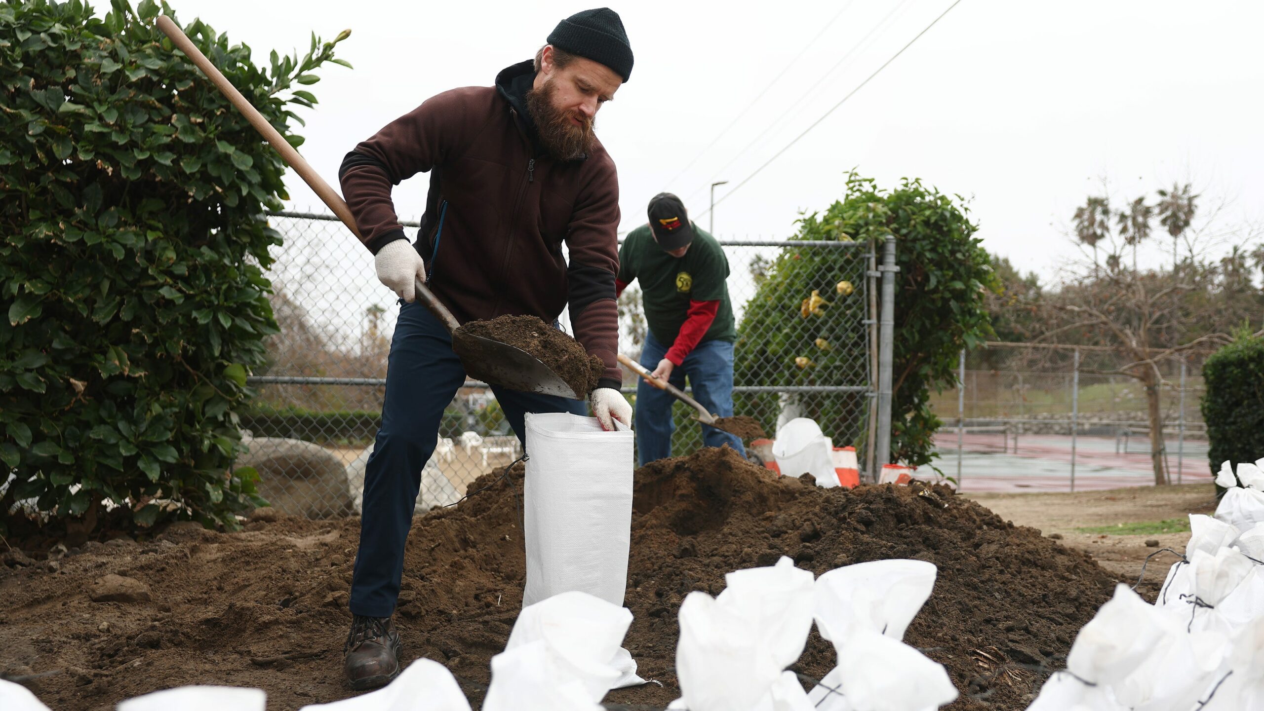
In preparation for the storm, crews have rushed to clear out 154 basins designed to catch mud, rocks and other debris from tumbling into neighborhoods. They have also installed thousands of sandbags, K-rails and compost filter socks — a type of berm — to keep dangerous debris from flowing into storm drains and out into the ocean.
In some areas, authorities were planning to use roadways to capture sediment, due to the amount of rubble and ash still in the burn scar areas, L.A. County Public Works Director Mark Pestrella said during a news conference Wednesday.
Pestrella said officials had also contacted properties adjacent to burned slopes to alert residents to the risk of possible landslides. Evacuation orders could be on the horizon, he said.
Anyone who lives in an area with a burned slope behind their home is at risk, Pestrella said, and he urged them to reach out to the agency by Wednesday afternoon with any concerns.
“This great event, it does present a higher risk to our residents,” he said, “particularly those that are living within the burn scars — not only Palisades, Eaton fire areas, but any burn scar area within the last year.”
Although last week’s storms brought only mild rain to the area, officials said it was enough that the basin at the Eaton wash dam filled with debris. Crews have since removed 150,000 cubic yards of mud, vegetation and rocks from that basin to give it additional capacity for this storm, Pestrella said.
Pestrella emphasized that officials had prepared for the incoming storm and that debris basins should have enough room for the size of the storm that’s anticipated. He added that crews had been working “24/7 for the last couple weeks trucking debris out of these areas.”
The first wave of what was expected to be the strongest storm of the winter began hitting Southern California on Wednesday, but the most damaging rains, which bring an enhanced risk of debris flows, are expected Thursday.
Los Angeles County Supervisor Lindsey Horvath said she understood that Angelenos might be experiencing “emergency fatigue” but urged people not to ignore this storm.
“Staying on high alert for this extended period of time is challenging,” Horvath said. “Stay with us, stay informed.”
Rain will be hitting virtually all parts of California this week, from the Bay Area to San Diego County.
A worst-case scenario for L.A. County in this storm could involve heavy rainfall over recently burned areas that dissolves soil into flows of debris barreling down hillsides at speeds of up to 35 mph, covering cars and homes with thick muck and putting them at risk of being struck by boulders.
“When you wake up tomorrow morning and you’re looking outside and you just kind of see that light, moderate rainfall, know that heavier rainfall could occur at any time,” said Ryan Kittell, a meteorologist with the weather service’s office in Oxnard. “Things could escalate very fast.”
The highest risk for debris flows and road flooding in Los Angeles County was expected to be between 2 p.m. and 10 p.m. Thursday. For Santa Barbara and San Luis Obispo counties, the peak risk is slightly earlier, from Thursday morning through the evening.
After blistering criticism that Southern California officials weren’t prepared ahead of the historic firestorms, government authorities say they have worked to reduce the risk of flooding impacts.
In Southern California this week, Kittell said the most likely outcome was “shallow” debris flows in burn scar areas, covering roads with mud. Thicker mudflows might be capable of immersing parked cars in mud.
“There’s also a risk for more significant debris flows, where it starts to impact a few vulnerable structures,” Kittell said. “While that isn’t the most likely outcome, the risk is there.”
Flood watches, in effect for all recent burn areas in Los Angeles and Ventura counties, are set to take effect starting at 10 a.m. Thursday and lasting through 10 p.m. A flood watch for Santa Barbara County’s Lake fire burn scar will be in effect from 10 a.m. to 7 p.m. Thursday.
And all of San Luis Obispo County will be under a flood watch from 4 a.m. until 6 p.m. Thursday.
A flood watch is also expected for a wide swath of San Diego and Orange counties and the Inland Empire beginning Thursday morning and lasting through late Thursday night.
The highest risk of excessive rainfall — the type that could produce flash flooding — will be in downtown L.A., South L.A., the Westside, the San Gabriel and San Fernando valleys, and large swaths of Ventura and Santa Barbara counties.
In Northern California, soils around the San Francisco Bay Area may be sufficiently saturated by Thursday morning. There may be “widespread shallow landslides” in the wettest areas, the weather service office in Monterey said, adding that strong winds could lead to damaged trees and power outages.
Meteorologists were closely watching for potential flooding of Sonoma County’s Russian River near Guerneville and Mark West Creek, and the San Lorenzo River, which travels through the heart of Santa Cruz County.
Flood watches were expected in San Francisco, San Mateo, Santa Cruz, Monterey, Sonoma and Marin counties from 10 p.m. Wednesday to 10 p.m. Saturday. From Wednesday night through Friday, a flood watch was also expected for the Sierra foothills east of the San Joaquin Valley.
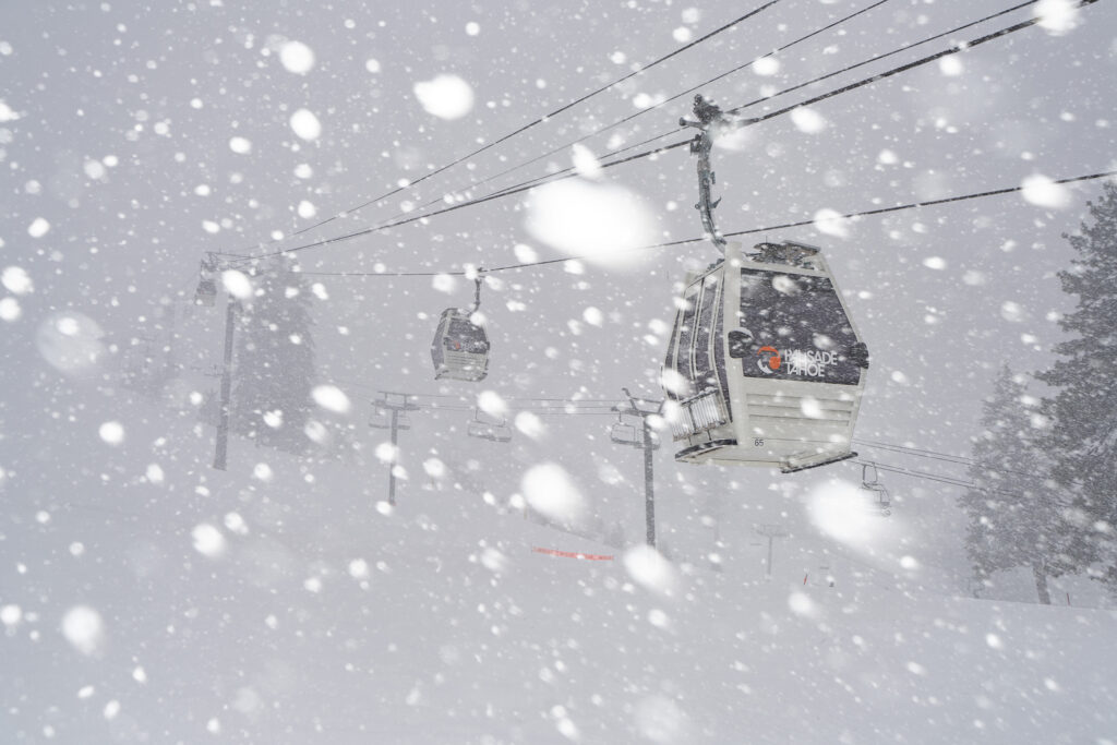
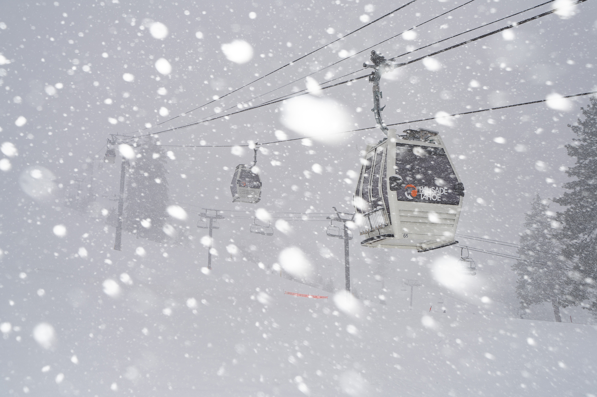
Heavy snow was expected in the Sierra Nevada, with 2 to 4 feet expected along the Sierra crest near Lake Tahoe, and 10 to 18 inches at lake level. In Mono County, home to Mammoth Mountain, 4 to 5 feet of snow could fall along the Sierra crest.
In Southern California, burn areas most at risk are those scorched in the Palisades and Franklin fires in Pacific Palisades and Malibu; the Eaton fire in the Altadena area; and the Bridge fire in the San Gabriel Mountains, west and southwest of Wrightwood.
“They’re in areas which tend to get enhanced rainfall amounts and rates,” Kittell said. But all fresh burn scars have some risk of debris flows.
Over the three-day storm, the Palisades scar area is expected to receive between 3 and 4 inches of rain; the Eaton scar, 5.08 inches; and the Bridge scar, 5.27 inches. Downtown Los Angeles could get 2.02 inches of rain; Long Beach, 1.99 inches; Santa Barbara, 2.79 inches; San Luis Obispo, 3.60 inches; and Cambria, 4.22 inches.
The last time downtown L.A. received that much rain was the 2024 Easter weekend storm, March 29-31, when 2.1 inches fell. The difference with that storm, however, is that it came following two consecutive wet winters, and did not follow severe wildfires.
By Friday, Palm Springs could get seven-tenths of an inch of rain; San Diego, up to 1.5 inches; Riverside, Irvine, Oceanside, Escondido and San Clemente, up to 2 inches; San Bernardino and Riverside, up to 2.5 inches.
For San Diego and Orange counties and the Inland Empire, the storm is expected to be neither a washout nor “the worst storm we’ve ever seen,” said Alex Tardy, meteorologist with the National Weather Service office in San Diego.
Although “not catastrophic,” he said, “we are going to see some locally heavy rainfall, and that could cause some flooding, especially mud and debris on our burn scars, and then your normal urban flooding.”
Officials in Orange County issued a voluntary evacuation warning for the Trabuco Canyon, Hot Springs Canyon, Bell Canyon, Long Canyon and Modjeska Canyon areas because of the risk of debris flows near the Airport fire burn scar. The evacuation warning will take effect beginning at 8 a.m. Thursday.
They also advised people to stay off the roads if possible on Thursday and heed evacuation warnings if they are issued. On Wednesday, Santa Barbara County issued an evacuation order for portions of the area in and around the burn zone of the Lake fire in the mountains north of Los Olivos. That fire scorched more than 38,000 acres in the Los Padres National Forest in 2024.
And in San Bernardino County, officials issued an evacuation warning at 6 p.m. for the community of Highland, along the Line fire burn scar. That fire ignited in September and scorched 43,978 acres in the San Bernardino National Forest. Justin Wayne Halstenberg, of Norco, was charged with 11 arson-related crimes for allegedly starting the Line fire.
As forecasters watch the burn scars, they’ll be paying particular attention to rainfall rates. The risk for debris flow in recently burned areas starts at around half an inch per hour.
“With our burn scars, intensity trumps total accumulations,” Kittell said. “So it’s not how much rain falls over a long period of time, but how much rain falls in a short period of time.”
Los Angeles, Ventura, Santa Barbara and San Luis Obispo counties could see intense rainfall rates of between half an inch to 1 inch per hour during the peak of the storm.
“Enhanced cells,” he said, could bring short bursts of precipitation — “30 to 60 minutes of pretty intense rainfall.”
The risk of thunderstorms has increased and is now estimated to be 10% to 20% on Thursday, up from 5% to 10%, Kittell said.
Significant wind gusts from the south are expected. Covina and downtown L.A. could see peak wind gusts of 21 mph; Long Beach, 23 mph; Redondo Beach and Canoga Park, 25 mph; Santa Barbara, 26 mph; Santa Clarita, 39 mph; Thousand Oaks, 28 mph; Pyramid Lake, 45 mph; San Luis Obispo and Santa Maria, 40 mph; and Lancaster and Acton, 54 mph.
“These are some pretty high numbers, especially if you look at the Central Coast,” Kittell said. Areas of the Central Coast, including around Cambria, are at high risk of downed trees.
Officials urged residents to sign up for emergency alerts with their local agencies. In Los Angeles County, residents can sign up at Ready.LACounty.gov.
They also advised people to stay off the roads if possible Thursday and heed evacuation warnings.
After this storm exits, no more rain is expected next week, and possibly for the rest of February, Kittell said. Forecasters expect warmer weather starting this weekend.
Sign up for Essential California
The most important California stories and recommendations in your inbox every morning.
You may occasionally receive promotional content from the Los Angeles Times.
Rong-Gong Lin II is a Metro reporter based in San Francisco who specializes in covering statewide earthquake safety issues and the COVID-19 pandemic. The Bay Area native is a graduate of UC Berkeley and started at the Los Angeles Times in 2004.
Hannah Fry covers breaking news for the Los Angeles Times. She most recently covered Orange County for The Times and has written extensively about criminal trials, housing, politics and government. In 2020, Fry was part of the team that was a Pulitzer finalist for its coverage of a boat fire that killed 34 people off the coast of Santa Barbara. Fry came to The Times from the Daily Pilot, where she covered coastal cities, education and crime. An Orange County native, Fry started her career as an intern at the Orange County Register.
Grace Toohey is a reporter at the Los Angeles Times covering breaking news for the Fast Break Desk. Before joining the newsroom in 2022, she covered criminal justice issues at the Orlando Sentinel and the Advocate in Baton Rouge. Toohey is a Maryland native and proud Terp.
Clara Harter is a breaking news reporter at the Los Angeles Times. Previously, she covered politics and education for the L.A. Daily News. While at the Daily News, she published a series on fentanyl addiction that won a first-place investigative journalism award from the L.A. Press Club. Harter majored in political science and Middle Eastern studies at Columbia University. She loves surfing and, when not reporting, can most likely be found in the ocean.
CALIFORNIA
TELEVISION
HOLLYWOOD INC.
HOLLYWOOD INC.
CALIFORNIA
CALIFORNIA
CALIFORNIA
CALIFORNIA
Subscribe for unlimited access
Site Map
Follow Us
MORE FROM THE L.A. TIMES
More to Read
Strongest storm in a year bearing down on Southern California: What you need to know
L.A. prepares for debris flows, slides in major rainstorm expected this week
Major atmospheric river storm is barreling toward California: ‘Prepare for the worst’
More From the Los Angeles Times
Authorities close more beaches, impose advisories on others. Here’s why
Teddi Mellencamp, ‘RHOBH’ alum, has urgent brain surgery after multiple-tumor diagnosis
Rebecca Kutler named president of MSNBC
L.A.’s classical KUSC will merge programming with San Francisco sister station
Most Read in California
After 30 years, In-N-Out leaves corporate office in Orange County
UCLA suspends Students for Justice in Palestine after vandalism at UC regent’s home
Riverside Sheriff Chad Bianco, an avid Trump backer, will join the 2026 governor’s race
Judge sides with UC students, blocks DOGE from Education Department loan data
Subscribers are Reading
Inside the bare-knuckle legal brawl between Blake Lively and Justin Baldoni
After this Australian town burned down, experts warned against rebuilding. Nobody listened
Will Trump have a chilling effect on Hollywood? Insiders say it’s already happening
What the Eaton fire could mean for Edison’s bottom line
Feds won’t test soil after L.A. wildfire cleanup, potentially leaving contamination behind
Latest California
‘Magical, Alluring’: Huntington Beach panel approves ‘MAGA’ plaque for city library
Trump administration may send immigrants to Bay Area ‘rape club’ prison, email shows
He stole from mourners visiting gravesites and ran up their credit cards, D.A. says
Gardena man faces two felony charges for allegedly pointing laser at LAPD helicopter
San Francisco gives new mayor expedited powers to tackle drug use, homelessness
Major storm is set to batter California. Here’s when impacts will be most intense
A powerful low pressure system will be sitting just off the California coast on Thursday morning.
A complex and powerful storm system will approach the California coast late on Wednesday evening and persist through Friday, bringing with it heavy rain, strong winds and feet of Sierra snow.
On Wednesday afternoon, a storm system will develop off the coast of California following a weaker one that moved through in the morning. This storm system will strengthen rather quickly, bottoming out with a central pressure level in the 980 millibar range, which is close to record strength for a storm system in the eastern Pacific for this time of the year.
As the storm strengthens, it will tap into a moderately strong atmospheric river extending toward Hawaii. Late Wednesday night and into Thursday morning, a sharp cold front will develop along the atmospheric river boundary. That front will quickly move down the California coastline on Thursday morning, bringing periods of moderate to heavy rain from the Bay Area all the way down to San Diego.
On Thursday, the parent low-pressure system will slow down as it approaches the California-Oregon border, and the upslope snow machine will be working in full force. Several feet of snow are expected across the Sierra by Friday morning. As this low-pressure system gets closer to the California coast, wind gusts will pick up. That’s especially true along the immediate coastline and highlands over 2,000 feet, where wind gusts will be up to 60-80 mph at times.
The storm center will slow down and hover offshore through Friday morning.
The low-pressure center will continue to linger just off the coast of Northern California into Friday morning. That will keep the heavy snow cranking in the Sierra, but it will also raise the risk of scattered heavy rain showers and thunderstorms. This is especially true across Northern California, the Bay Area and Central Coast.
By Friday afternoon, the center of the storm system will dissipate and precipitation will become more scattered in nature before shutting off completely by Friday afternoon. High pressure will quickly build on Saturday and sunshine will return, setting up an excellent opportunity to take advantage of the fresh powder in the Sierra.
Steady rain will move into the Bay Area sometime between 4 p.m. and 7 p.m. on Wednesday. Rainfall rates will quickly increase on Wednesday night and into early Thursday morning as a strong front approaches. Some of the heaviest bursts of rain will fall across the region between midnight and 7 a.m. on Thursday when many locations could pick up an inch or two of rain in just a few hours and even higher amounts in the elevation on the Peninsula and the Santa Cruz Mountains.
Rainfall totals will range from 2 inches to 4 inches across the Bay Area by Friday morning.
A brief lull in the steady rain on Thursday morning won’t last long. Scattered showers will return by Thursday afternoon and persist into the evening. Some of these showers will feature bursts of heavy rain and maybe even a rumble of thunder, with the North Bay having the best chance at seeing some storm activity.
A high wind warning has been issued for the immediate coastline starting on early on Thursday and lasting through Friday morning when wind gusts could reach 80 mph at times. The rest of the Bay Area is under a wind advisory as wind gusts of 40 to 50 mph are in the forecast, with higher gusts possible at higher elevations.
By Friday morning, rainfall totals will generally be 1-3.5 inches in San Francisco, the Peninsula and the East Bay. Along the immediate coast and in the Santa Cruz Mountains, totals will be higher, around 4-8 inches. Meanwhile, the North Bay can expect around 2-3 inches of rain.
It appears that the heaviest rain will fall across Southern California during the initial frontal passage early on Thursday afternoon. As that cold front approaches, moderate to heavy rain will break out across Los Angeles, San Diego and the hills and mountains that surround the cities.
Thursday afternoon looks to be the timeframe with the biggest concerns for debris flows to develop in the vicinity of recent burn scars. That’s when rainfall rates could exceed 0.5 inches per hour in Santa Monica, San Gabriel and Sierra Madre mountain ranges. Much of the steady rain will be done by Thursday evening, with just scattered showers lingering into Friday.
Rainfall totals will be high along the Central Coast but will trend lower down into Southern California.
Winds on Thursday will be strong as well, gusting 50-65 mph along the coast and back through the elevated terrain. By Friday, rainfall rates will generally range from 1 inch to 3 inches in and around Los Angeles and San Diego, with 3-6 inches falling in the mountains around the cities.
Snowfall levels are expected to hover around 6,000-8,000 feet on Thursday and Friday, which is low enough to bring some snow to the higher peaks of Southern California. But it’s still unclear how much snow will fall, as precipitation is likely to flip back and forth between rain and snow, as snow levels fluctuate.
The Central Coast may end up being the jackpot for rainfall amounts with this storm system. As the frontal boundary moves down the coast on Thursday morning, some pockets of heavy rain will develop in the vicinity of the Big Sur and the Santa Lucia Mountains, where upward of 8 inches of rain could fall in some spots by Friday morning.
Otherwise, 3-6 inches of rain is expected across the Central Coast and interior.
Strong winds up to 65 mph are in the forecast for the immediate coastline with weaker gusts inland. Scattered showers and a few thunderstorms are likely to develop on Thursday evening and potentially on Friday morning, especially in the mountains south of Monterey.
While Northern California will be closer to the center of the storm system, the heaviest precipitation looks like it will fall south of the region, following the path of the southward tracking frontal boundary.
Nevertheless, moderate to heavy rain will develop on Wednesday evening along the Northern California coast and back across the interior. In general, about 2-4 inches of rain will fall along the Northern California coast, with 1-3 inches of rain falling across the interior valleys. A few feet of snow will fall around Mount Shasta and some of the higher elevations of the Cascade Range.
Enough cold air could be in place around the Central Valley foothills to generate some measurable snow at lower elevations, including places like Redding. That may impact travel for a period of time on Interstate 5, especially in the early morning hours of Thursday.
By Thursday afternoon, the steadiest rain will have shifted to the south, but the threat of showers and some thunderstorms will be high. As the center of the storm system meanders off the Northern California coast, the atmosphere will remain rather unstable, setting up a favorable environment for storm development.
The Sierra will get buried in snow with this storm system, with upward of 5 feet of snow falling around Yosemite and Mammoth. Tahoe will also see several feet of snow by Friday morning as snowfall levels hover around 6,000-7,000 feet for the entire duration of the storm.
Reach Greg Porter: greg.porter@sfchronicle.com; Bluesky: @gporterwx.bsky.social
Greg Porter is a senior newsroom meteorologist at the San Francisco Chronicle. Porter comes to Chronicle after seven years working as a meteorologist for the Capital Weather Gang at the Washington Post. Porter has also worked as a meteorological technical subject matter expert in for both government and commercial organizations around the world.
Porter received his Bachelors and Masters Degrees in Atmospheric Science from UMass Lowell and the University of Maryland. A native of Boston, Porter has also spent time living in Washington, D.C. and Edinburgh, Scotland.
Outside of work, Porter loves to spend time with his wife and very energetic 2 year old son. He also enjoys spending as much time outside as possible and he fancies himself a very average golfer.
Only subscribers can read articles in this mode. To continue, log in or subscribe or turn off your ad blocker.
California storm timeline
Greg Porter is a senior newsroom meteorologist at the San Francisco Chronicle. Porter comes to Chronicle after seven years working as a meteorologist for the Capital Weather Gang at the Washington Post. Porter has also worked as a meteorological technical subject matter expert in for both government and commercial organizations around the world.
Porter received his Bachelors and Masters Degrees in Atmospheric Science from UMass Lowell and the University of Maryland. A native of Boston, Porter has also spent time living in Washington, D.C. and Edinburgh, Scotland.
Outside of work, Porter loves to spend time with his wife and very energetic 2 year old son. He also enjoys spending as much time outside as possible and he fancies himself a very average golfer.
Top Of The News
Major storm is set to batter California. Here’s when impacts will be most intense
Luxury spa to exit troubled S.F. mall, blames city for downtown’s ‘deteriorating’ conditions
Bankrupt retailer to shut a dozen Bay Area stores among 500 total closures
‘Our hospital is full to the brim’: California overwhelmed by severe flu season
Grimes slams Elon Musk for parading son in Oval Office: ‘He should not be in public like this’
Let’S Play
Bay Area
Southern California
Central Coast
Northern California
Sierra Nevada
You have ad-blocker turned on
Get Unlimited Digital Access for 25¢
California on ‘high alert’ as looming storm threatens flooding, mudslides, heavy snow
SAN DIEGO — California officials braced Wednesday for what could be the biggest rain storm of the winter season, prepositioning emergency personnel as they warn residents to avoid traveling during the expected downpours and prepare for possible evacuations.
An atmospheric river — the second to wallop the state in recent weeks — will bring 2 to 4 inches of rain to much of the California coast, with over 8 inches possible in some isolated areas, according to AccuWeather. Light rain began falling in parts of the state on Wednesday but the heaviest downpours are expected on Thursday as the storm moves into Southern California.
“This event could bring an increased risk of power outages, flooding in small streams and low-lying areas, and debris, rock and mudslides on roadways,” the California Governor’s Office of Emergency Services said in a statement. The agency deployed dozens of fire engines, rescue crews and helicopters to respond to potential emergencies in fire-ravaged areas.
The weather service office in Los Angeles said heavy rain over charred land “could trigger life-threatening and damaging flooding and debris flows.” Flood watches for portions of Northern California were set to take effect starting Wednesday evening while flood watches in Southern California will be in effect starting early Thursday.
The latest atmospheric river comes after a series of storms brought record daily rainfall to Northern California last week, triggering major floods that damaged houses and forced evacuations and water rescues. Officials said there were at least two storm-related deaths.
In addition to the rain, the incoming storm was set to blanket the Sierra Nevada mountains in multiple feet of snow this week, prompting officials to warn residents to avoid driving on mountain roads.
Ahead of the rain, state and local officials announced several measures to mitigate the potential for flooding and mudslides in areas impacted by the Palisades and Eaton fires that swallowed entire neighborhoods in the Los Angeles area last month.
The California Governor’s Office of Emergency Services said it prepositioned over 400 personnel in eight counties to fight floods and debris flows. At burn sites, thousands of miles of concrete barriers have been installed to prevent landslides, while over 300,000 sandbags have been given out to residents and business owners.
Dozens of soldiers with the California National Guard were also deployed to hasten the ongoing debris removal efforts. Officials warned people in areas impacted by the fires to prepare for mudslides by having a “go-bag packed and knowing evacuation routes.”
“We have city departments on high alert right now as rain makes its way across LA,” Los Angeles Mayor Karen Bass said in a post on X.
The National Weather Service issued a flash flood watch for burn areas in Santa Barbara, Los Angeles, and Ventura counties. Local authorities have urged residents to stay alert for changing conditions, noting that heavier downpours could cause localized flooding or flows in the region.
The Los Angeles Fire Department announced evacuation warnings in areas recently burned by the wildfires due to “possible debris flows.” Evacuation orders were also issued for specific addresses where mudslides are a “high risk.” The orders will be in effect from 7 a.m. local time Thursday until 2 p.m. Friday, according to fire department officials.
In Orange County, southeast of Los Angeles, a voluntary evacuation warning was issued for residents in the Airport Fire burn area — which burned over 23,000 acres last year. The warning is set to go into effect on Thursday morning.
A number of communities along the Line Fire burn scar and in the San Gabriel Mountains were under evacuation warnings, according to the San Bernardino County Sheriff’s Department.
The system will bring several feet of snow and high winds to the Sierra Nevada mountains, triggering winter storm warnings describing “difficult to impossible” travel conditions on mountain passes.
The weather service in Sacramento said snowfall rates could top 2 inches per hour in some areas, lowering visibility that could impact Thursday morning commutes. The heaviest snowfall is expected Wednesday night through midday Thursday.
The snowy weather was not only limited to California. Similar winter storm warnings were set to take effect in Oregon, Idaho, Nevada, and Utah as the weather system moves east over the coming days.
In Oregon’s Multnomah County, part of the Portland metropolitan area, officials extended a state of emergency through at least Thursday evening. The county opened six emergency shelters on Wednesday night after a total of 356 people came to the open five shelters on Tuesday.
The National Weather Service in Portland warned that freezing rain and snow will impact parts of Oregon and Washington state overnight into Friday. These conditions were also expected to impact major roadways, including Interstate 5, Interstate 205, and Interstate 84, according to the weather service.
Often referred to as “rivers in the sky,” atmospheric rivers are long, narrow tracts of the Earth’s atmosphere that gather moisture from the tropics near the equator and sweep it toward the poles.
They can vary greatly in size and strength, however, the average atmospheric river carries an amount of water vapor “roughly equivalent to the average flow of water at the mouth of the Mississippi River,” according to the National Oceanic and Atmospheric Administration.
Exceptionally strong atmospheric rivers can move up to 15 times that amount, often leading to “extreme rainfall and floods,” NOAA said.
Contributing: Dinah Voyles Pulver, USA TODAY; Cheri Carlson, Ventura County Star