57
by JEFF COX
TOPICS:
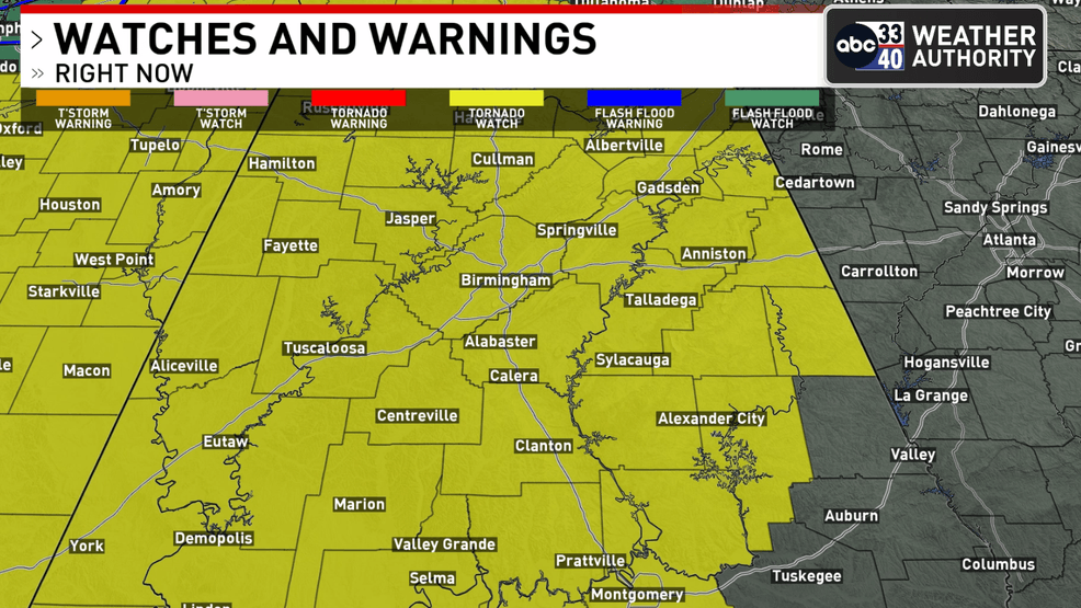
BIRMINGHAM, Ala. — The National Weather Service Storm Prediction Center has issued a tornado watch for much of Alabama, the western Florida Panhandle, southeast Louisiana, central and southern Mississippi, southern middle Tennessee, and coastal waters. The watch is effective from 9:10 p.m. Saturday until 4 a.m. CST Sunday.
Primary threats include the likelihood of a few tornadoes, with the possibility of a couple of intense tornadoes. Widespread damaging wind gusts up to 70 mph are expected, and isolated large hail events up to 1.5 inches in diameter are possible.
ABC 33/40 Chief Meteorologist James Spann emphasized the potential for strong, potentially damaging winds as the line of storms passes through Alabama. “With the saturated soil and the potential for damaging winds, you might consider taking action for a severe thunderstorm warning like a tornado warning tonight due to the potential for falling trees,” he said.
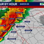
The line of thunderstorms is expected to enter the northwest corner of Alabama around 10 p.m. and move quickly through the state overnight. Spann noted that the main concern remains strong, potentially damaging straight-line winds, with the possibility of a few isolated tornadoes, especially over southwest Alabama.
“Gradient winds ahead of the line could gust to 30-40 mph in spots; a wind advisory is in effect,” Spann said. “The line will move quickly, rain amounts should be one inch or less for most places, and major flooding issues are not expected.”
Much of the state is under an “enhanced risk” (level 3/5) due to the wind potential. Residents are urged to have a reliable way of receiving severe weather warnings throughout the night.
ON ABC 33/40
TALK OF ALABAMA
LAWMAKERS
LEGAL
TRENDING
NEWS IN PHOTOS: “Local”
Severe Weather Live Stream
Category: Alabama’s Weather, ALL POSTS, Severe Weather, Social Media
If you enjoyed this article, subscribe to receive more just like it.
Comments are closed.
About the Author (Author Profile)
Subscribe
Live Severe Weather Stream
Day 1 Severe Weather Outlook
Subscribe to Our Mailing List
WeatherBrains 995: I’m The Girl They Didn’t Like
X Feeds
In Memoriam — J.B. Elliott
Craft Your Message on AlabamaWX
Contact Us
AlabamaWX Staff Bios
68
by Allen Strum
TOPICS:
WEAR-TV — A weekend weather maker is forecast to bring more storms to the Southeast.
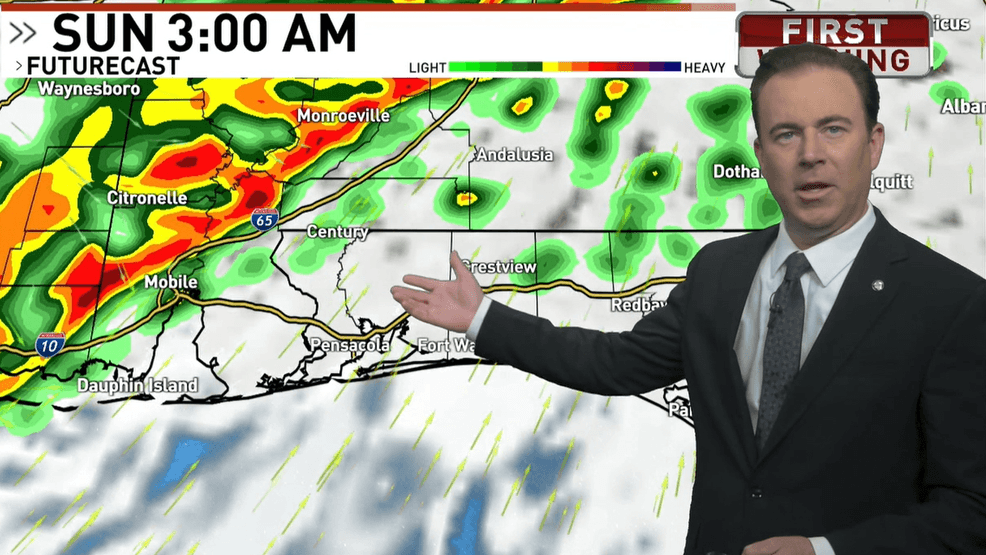
The most likely time for the WEAR-TV area to get struck is first thing Sunday morning. A line of storms is forecast to develop and move east across the South ahead and along a cold front.
The biggest threat will be damaging winds within the line. If supercell storms develop ahead of the line, the risk for tornadoes will be higher.
The Storm Prediction Center (SPC) has the WEAR-TV zone in a 2 out of 5 risk area, otherwise known as a slight risk zone for severe weather.
In its Friday afternoon forecast discussion the National Weather Service out of Mobile, Alabama said, “..a line of thunderstorms is expected to move across the area late Saturday evening through early Sunday morning. Strong vertical shear profiles and increasing instability levels will support the potential of severe storms along the line. The main threat will damaging wind gusts along the line. A few tornadoes cannot be ruled out especially along breaks and kinks in the line.”
Once the rain is out Sunday morning, cooler air will start to move back in and lows Monday morning are forecast to be down in the 30s. More cold weather is also forecast later in the week.